Follow the story of Ocean Carbon with Edukeo – Ocean Carbon. Which showcases the work of SCOPE and sister project OC4C.
After decades of ocean research, Earth Observation science is revealing the full picture of the ocean’s carbon – how much is absorbed, where it is stored or exhaled, and how this is changing over time.
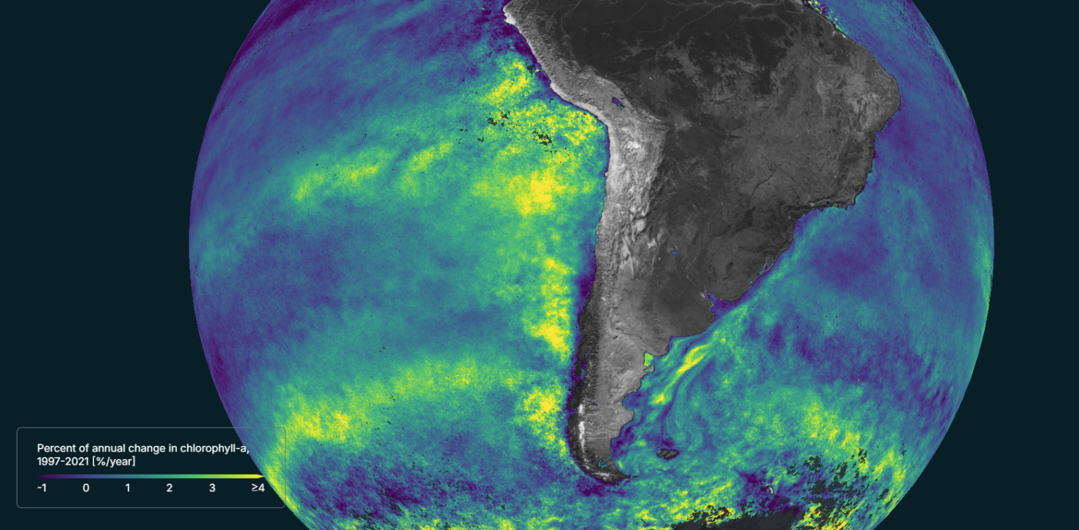
Satellites have monitored the ocean for over four decades. Since 2008, ESA’s Climate Change Initiative (CCI) has combined data from successive missions to create the long-term records needed to track ocean change, something no single satellite can do alone.
SCOPE (Satellite-based Observations of Carbon in the Ocean: Pools, Fluxes, and Exchanges) and sister project Ocean Carbon for Climate (OC4C) use these CCI data to produce research that feeds into major climate assessments, from the Global Carbon Budget and the Potsdam Institute’s Planetary Health Checks, to the Intergovernmental Panel on Climate Change reports that shape global climate policy.
“Scientists agree that the ocean carbon cycle is changing, but with climate change accelerating and so many interconnected processes at play, we’re seeing multiple changes happening at once, and as a scientific community we need to work together to fully understand exactly what changes are happening and where.” – Dr Gemma Kulk (SCOPE PI).
For the full story on Ocean Carbon visit: Edukeo – Ocean Carbon